
Places We Run
Barton Creek Mall Loop - Map - Directions - GPX Route
9.65 miles
A very challenging route with numerous hard climbs; the route loops around Barton Creek Mall, then backtracks most of the way back to the start. The second half (downhill return) is easier than the first half. Enjoy the view of downtown from the mall. You can shorten the route by skipping the mall loop, or by bypassing the Spyglass portion of the route.
Barton Hills Loop - Map - Directions -
9.05 miles
Also known as "The Lollipop" loop, this route is big on hills. The route takes the south side of the trail to Robert E. Lee Road, then turns onto Barton Hills Drive where the climbing begins. The "lollipop" portion rolls for almost 5 miles before returning to the trail.
Central Austin Loop - Map - Directions - GPX Route
13.11 miles
A variation on the Grove route that goes by Hancock Park and into east Austin on the return to add some extra mileage.
Escarpment - Map - Directions - GPX Route
7.4 miles
This route starts at Dick Nichols Park in southwest Austin, and is a "warmup" before "South Lab" pace work. The "warmup" is an out-and-back, and can be cut short to any distance (depending on turnaround point).
Exposition Downhills - Map - Directions
2 miles round-trip
This route starts at Exposition and Lake Austin Boulevard in West Austin. The purpose of this workout is to run very easy (1 mile uphill) from the start up to Exposition and Windsor, then run hard downhill from Windsor back to the start, e.g. at MGP or MGP minus 10-15 seconds. Repeat x 2, 3 or 4 depending on training level.
Exposition Downhills (Advanced) - Map - Directions
3 miles round-trip
This route starts at Exposition and Lake Austin Boulevard in West Austin. Just like Exposition Downhills (below), the purpose of this workout is to run very easy (1 mile uphill) from the start up to Exposition and Windsor, then run hard downhill from Windsor back to the start, e.g. at MGP or MGP minus 10-15 seconds -- but for this "Advanced" workout there is a very hilly detour along Bridle Path/Woodmont that creates an additional challenge and also lengthens the downhill to 2 miles instead of only 1 mile. Repeat x 2 or 3.
Far West Loop - Map - Directions - GPX Route
15.01 miles
Starts out the same as "Scenic Loop," but heads north on a tough climb up Balcones near mile 4. Crosses Mopac Expressway on Far West Blvd., then cruises mostly downhill until cross back over Mopac on 35th Street. The final 2.5 miles are essentially the same as Scenic Loop.
Great Northern Loop - Map - Directions - GPX Route
13 miles
This route starts at Murchison Middle School in northwest Austin, and is essentially a reverse of the "Far West Loop." The route generally trends downhill for the first half, and then is uphill back to the start.
Grove Loop - Map - Directions
9.14 miles
A simple loop route traveling north close to Mopac and turning on 45th St right at the Grove residential/commercial development. Returns South via N. Lamar Blvd. Trending uphill for the first half, and trending downhill for the return.
Hancock Loop - Map - Directions - GPX Route
13.0 miles
Starts out the same as "Scenic Loop," but heads north on a tough climb up Balcones near mile 4. Crosses Mopac Expressway on Hancock Drive, then cruises mostly downhill until cross back over Mopac on 35th Street. The final 2.5 miles are essentially the same as Scenic Loop.
Lost Creek - Map - Directions - GPX Route
12 miles
This route starts in the City View Office Park at Lost Creek Boulevard and Loop 360 in the Westlake area of Austin. The nickame for this route is "Don't Get Lost in Lost Creek" for a reason: if you do not follow the directions closely, you can get lost pretty easily because the streets twist, bend, and turn back on themselves everywhere. But this is not cause for concern, because you can always find the main road, Lost Creek Boulevard, from just about anywhere (or, since this is a residential area, you can ask anyone walking or driving by how to get back to Lost Creek Boulevard). The real challenge of this route is the endless hills. There are very few flat areas of this route, and some of the climbs and descents are dramatic.
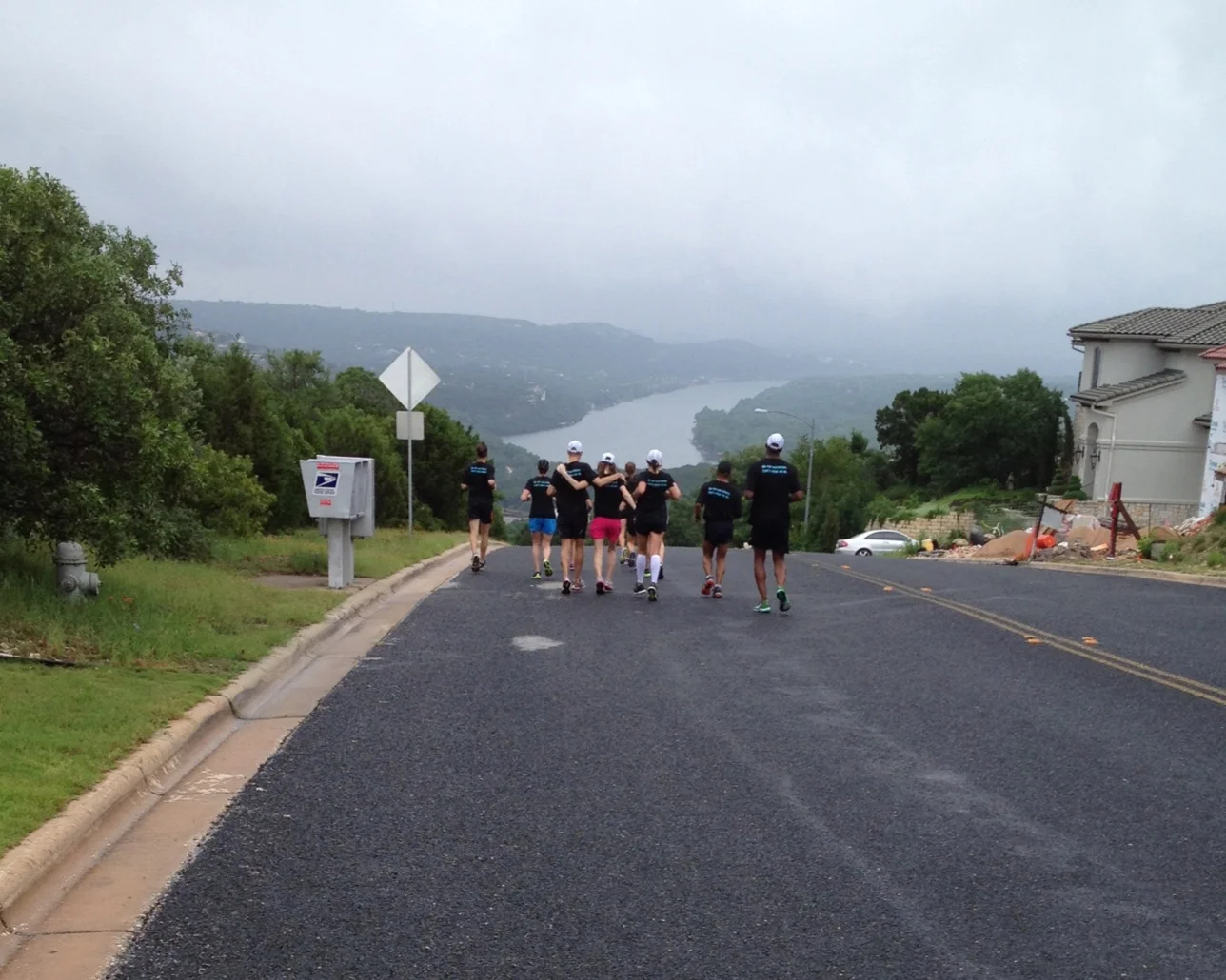
Mount Bonnell Loop - Map - Directions - GPX Route
10.0 miles
This is essentially the "Scenic Loop," but adds a very challenging 2-mile loop up Mt. Bonnell Road, along Mt. Bonnell Drive, and then down Edgemont and Balcones.
Mueller - Map - Directions - GPX Route
14.96 miles
This route heads east past the Capital on 11th and up through UT campus and past the stadium. Route continues down Dean Keeton/Manor Road to the Mueller area for a loop before returning.
O. Henry Mile Repeats - Map - Directions
1 mile
This route starts at O. Henry Middle School in West Austin. The route is a 1-mile loop. The goal is to run these at MGP + 10-15 sec/mi, not faster than MGP. The typical long run workout includes a warm-up of 3-7 miles before starting these repeats.
Phil’s Hills - Map - Directions
Approx. 4 miles
This is our weekly hill workout starting at Phil’s Ice House on South Lamar. Lots of hills!
Pleasant Valley Loop - Map - Directions - GPX Route
9.64 miles
This route goes through East Austin and turns south at the Boggy Creek Greenbelt area, returning via the North side of the hike and bike trail.
Raleigh Run - 9 miler - Map - Directions
Approx. 9 miles
This route is much like the "Scenic Loop," but cuts that route short by returning east along Windsor to Exposition instead of Scenic Drive. At Exposition just south of Windsor, the route begins a series of switchbacks on very rolling hills. The route then finishes along Exposition much like Scenic.
Raleigh Run - 11 miler - Map - Directions - GPX Route
Approx. 11 miles
This route is exactly the same as the "Scenic Loop," but adds additional miles using a series of switchbacks on very rolling hills between Exposition and Raleigh. The route then finishes along Exposition and Lake Austin Boulevard just like Scenic.
Scenic Loop - Map - Directions - GPX Route
8 miles
Very popular route with Austin training groups. Starts out easy, tough short hills right around miles 2.5 - 4, finishes with rolling hills along Exposition at the end.
Shoal Creek Out-And-Back - Map - Directions - GPX Route
18+ miles
This route heads through West Austin, across Mopac into central Austin, and further north into the Shoal Creek area. It is an out-and-back course, which means that runners should turn around at the mile marker that is half of their total mileage for the long run. The full out-and-back is just over 18 miles. The route trends mostly uphill going out, then downhill on the return.
South Lab - Map - Directions - GPX Route
3.5 miles
This route starts at Dick Nichols Park in southwest Austin. This is a simple loop that is part of a "goal pace" long run. After a warmup of anywhere from 5-10 miles, the goal is to run 1-4 loops (3.5 miles up to 14 miles) at goal pace, or something close to goal pace (depending on training level and week # of training plan).
South Lab Warmup - Map - Directions
9 miles
This route starts at Dick Nichols Park in southwest Austin, and is a "warmup" before "South Lab" pace work. The "warmup" is an out-and-back, and can be cut short to any distance (depending on turnaround point). The route generally trends uphill to the turnaround point at mile 4.5, and then is a gradual downhill route back to the start.
Triangle Loop- Map - Directions - GPX Route
9 miles
This route starts through the edge of downtown Austin, heads north near the UT campus, loops around “The Triangle” in north central Austin, then trends back downhill through the Shoal Creek area.
University Loop - Map - Directions - GPX Route
12 miles
Starts out the same as "Scenic Loop," but heads east towards UT Campus near mile 5. Finishes through campus, Capitol grounds, and Congress Avenue before returning to the trail.
Via Fortuna Loop + Gaines Loop - Map - Directions - GPX Route
9.1 miles + 3.5 miles
This route starts out easy with a flat run along 5th Street to Lamar, across Lake Lady Bird via the Pfluger Footbridge, and then along Barton Springs Road before cutting through the south side of Zilker Park. After that point, the route becomes very challenging, with numerous climbs. The route backtracks part of the way before returning to Lake Lady Bird, across the Crenshaw Footbridge, and then back to the start.
Westlake Challenge - Map (and Zilker Circle) - Map - Directions - GPX Route
5.5 miles
(Zilker Circle is 1.2 miles)
This route starts at Cedar Creek Elementary School in Westlake. It opens with a nice downhill, and ends at the "Zilker Circle" in Zilker Park. The return route is what gives this one its name -- the "challenge" is the return from the park back to the school, with tough uphills. This route combination is often used for runners who are training for the rigors of miles 16-21 in The Boston Marathon. The Zilker Circle is where Boston trainees usually do 5 loops (6 miles) at their marathon goal pace before running the "challenge" back to the school.
